


Sending ripples
channeling a transparent hydrological future forward

Abstract
Visible, open, communal water infrastructure features prominently in the placemaking of historical landscapes, from the terraces of Battir, Palestine, to the acequias of New Mexico. Not so in our Western industrialized world where drainage and pipes dispose of water below ground. Suburban development continue to rely on underground systems, depriving residents of a meaningful connection to water. As climate change increases the vulnerability of these aging systems, an opportunity emerges to design more resilient and purposeful infrastructure systems. To foster a stronger sense of place, an open water system tailored to the hydrological particularities of site (rainfall, springs, streams, etc) may generate alternative residential neighborhood configurations. Topographies gently regraded to direct runoff through a connected network of swales, gardens, and reservoirs—transforming landscapes to harvest and circulate water sources. Residents are offered the ability to block or release channels based on water needs, allowing for active participation in water management. Native ecologies around neighborhoods can be more easily reintroduced to help restore the hydrological cycle disrupted by decades of commercial agriculture and urbanization. An alternative design strategy is necessary for residents to trace, maintain, and interact with water, reducing government financial burdens and in turn deepening the community’s everyday relationship with the landscape. To enable a frictionless path to adoption and seamless workflow across disciplines, my doctoral research will propose suggestions for design manuals to incorporate visible, open, communal water infrastructure guidelines.

Methods
Meta-analysis of Western Water Infrastructure Design Codes
To map existing systems of design, a meta-analysis of Western engineering codes is essential. This will be conducted through a combination of online research and field methods. The countries in focus are the United States, Canada, Great Britain, Australia, and New Zealand. A high-level overview of each country's ecosystems, climate, land use typologies—urban, agricultural, residential, and beyond—as well as their public spending on water infrastructure, will be developed.
Online Research
This component involves identifying and annotating leading water infrastructure design manuals. Special attention will be given to the organization, framework, language, units, underlying engineering principles and contributors that structure these manuals. The analysis will explore both the strengths and limitations of each manual, while acknowledging the historical contexts that shaped their development—who they were designed for, and under what conditions. Additionally, the research will investigate contemporary discourse within each society regarding the reinterpretation and revision of their respective water infrastructure guidelines. At the present moment, the following design manuals were identified for research:
United States
EPA Stormwater Best Management Practice Design Guide Volume 1 General Considerations
ASCE/EWRI 45-05, 46-05, and 47-05
ASCE Design and Construction of Urban Stormwater Management Systems
North Carolina Stormwater Design Manual
New York Stormwater Management Design Manual
Canada
Ontario Ministry of the Environment, Conservation and Parks (MECP): Stormwater Management Planning and Design Manual (2003)
Low Impact Development (LID) Stormwater Management Planning and Design Guide (2010)
British Columbia: Stormwater Planning: A Guidebook for British Columbia (2002)
City of Sarnia Stormwater Management Design Guidelines (2024)
Alberta: City of Calgary Stormwater Management & Design Manual (2011)
Great Britain
National Standards for sustainable drainage systems Designing, constructing, operating and maintaining drainage for surface runoff
Environmental Agency - Rainfall runoff management for developments Report – SC030219
Department of Environmental Food and Rural Affairs - Surface Water Management Plan Technical Guidance
Australia
AS/NZS 3500.3:2025 – Stormwater Drainage
Australian Guidelines for Urban Stormwater Management (2000)
Managing Urban Stormwater: Soils and Construction (The Blue Book)
Queensland Urban Drainage Manual (QUDM)
City of Melbourne Stormwater Drainage Design Guidelines (2023)
City of Sydney Stormwater Drainage Manual (2017)
New Zealand
AS/NZS 3500.3:2025 – Stormwater Drainage
Water New Zealand – On-Site Stormwater Management Guidelines
Auckland Council – Stormwater Code of Practice
Stormwater Treatment Standard for State Highway Infrastructure
Field Methods
Photographic documentation, sketching, networking, and in-depth interviews will provide a nuanced understanding of each culture’s specific infrastructural needs and aspirations. Moreover, attendance of workshops, seminars and conferences in each respective country will enable a comprehensive understanding of the dynamics which shape water systems. The order of annual field visits may shift depending on the start date of the Fulbright award. Given the researcher’s familiarity and existing connections within the United States, a full year of field methods may not be necessary there.
Pending proposal approval, the researcher will reside in New Zealand under a working holiday visa until September 2026. Beginning with Aotearoa (New Zealand) is strategic for doctoral research for multiple reasons. First, the living history between the indigenous Maori peoples and settler Europeans provides a precedent on how native cultures have survived and continue to persevere within modernity. Secondly, the Maori have made strides to have their customs and oral traditions reflected in the crown government particularly in engineering standards. Lastly, the bi-cultural legacy of Aotearoa provides an ongoing example of overcoming colonial pasts and working towards a better future that works for all.
Upon acceptance of the research proposal and commencement of the doctoral program, the following fieldwork schedule is anticipated.
USA 2025
ASCE National Conference - Seattle October 2025
New Zealand 2025 - 2026
Attended Stormwater Conference in Rotorua this past May
Great Britain (2026-2027)
Water, Wastewater & Environmental Management Expo (WWEM)
NCE Water Conference 2025
Australia (2027-2028)
Stormwater Victoria Conference
International Conference on Water-Sensitive Urban Design and Policy (ICWSUDP)
IECA Australasia Conference & Expo
Canada (2028-2029)
Source to Stream Conference
International Conference on Water Management Modeling (ICWMM)
Canadian Water Resources Association (CWRA) National Conference
Ontario Water Conference & Trade Show
Open, visible communal infrastructure historical examples around the world
The wisdom of ancient systems is timeless. Unlike the modern nation-state model—optimized for speed and power—pre-modern systems were attuned to celestial cycles and climate rhythms, rooted in place, ceremony, and kinship. For modern societies to meaningfully adopt open, visible communal infrastructure, a rigorous breakdown and reverse engineering of these traditional systems is required. This would allow their principles to be standardized and seamlessly integrated with today’s design tools. The process should mirror the analytical techniques used to study modern systems—both online and in the field—while remaining flexible enough to accommodate the unique characteristics of pre-modern models.
Online research
The United Nations maintains a database of internationally recognized heritage sites, which will serve as a benchmark for developing design guidelines for open, visible communal water infrastructure. As part of my research, I intend to catalog and deconstruct the water infrastructure systems found within UNESCO World Heritage sites, analyzing their components in detail. In parallel, the Lo–TEK Institute offers a valuable repository of indigenous architectural practices—though not always explicitly focused on water infrastructure. However, their forthcoming publication Water, scheduled for release in Fall 2025, may engage more directly with the themes of this proposal. A key outcome of this research could be the development of a navigable matrix—a structured, searchable tool cataloging location, date, construction methods, form, function, preservation status, and other relevant attributes—to ensure that this knowledge remains accessible and actionable.
Field Methods
In the summer of 2023, I was sponsored by the Columbus Foundation to conduct field research in the mountainside village of Battir in Bethlehem, Palestine—a UNESCO World Heritage site. This enriching experience helped shape the trajectory of my research early in my master’s studies at The Ohio State University and ultimately informed my capstone project. It also opened the door to further exploration of UNESCO heritage sites, including the Subak system of Bali, Indonesia. I aim to continue conducting fieldwork in indigenous and traditional contexts to deepen my understanding and appreciation of time-tested infrastructure practices.
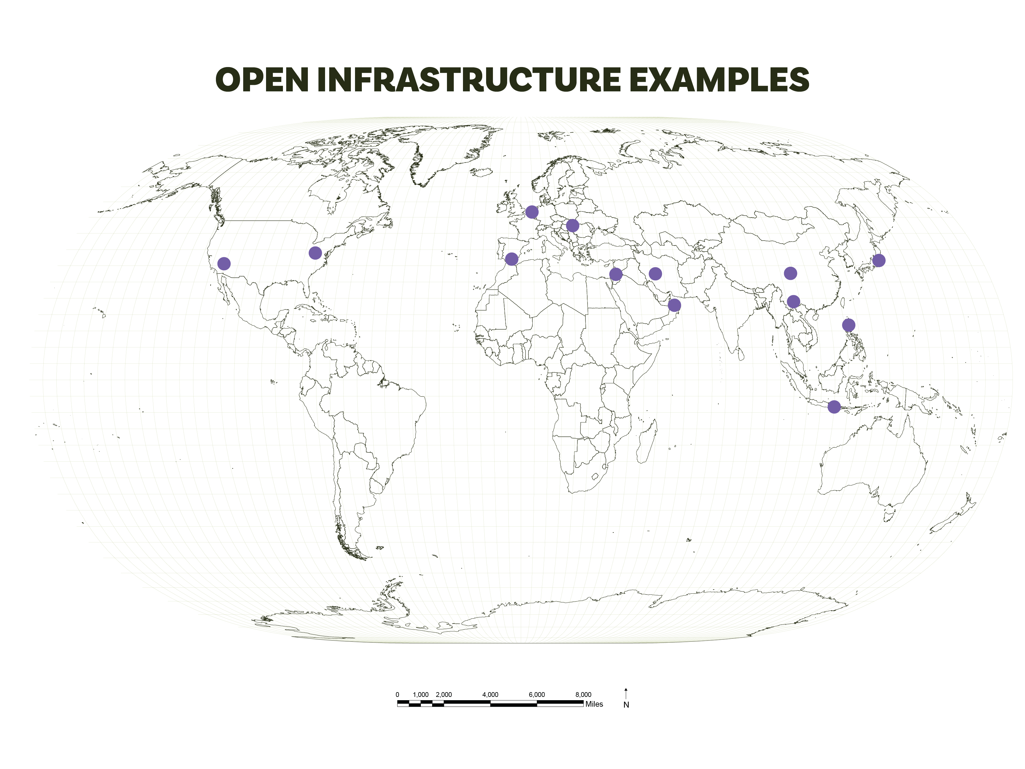
During upcoming academic breaks, I hope to visit the following sites—each strategically selected for its relevance to water infrastructure and cultural landscape design. These locations are currently on my radar and marked on my research map:
https://whc.unesco.org/en/tentativelists/1826/
https://whc.unesco.org/en/list/818
https://whc.unesco.org/en/list/1207/
https://whc.unesco.org/en/list/1001/
https://whc.unesco.org/en/list/1506/
https://whc.unesco.org/en/list/722/
https://whc.unesco.org/en/list/353/
https://whc.unesco.org/en/list/1423/
https://whc.unesco.org/en/list/1026/
https://whc.unesco.org/en/list/1333/
https://whc.unesco.org/en/list/474/
https://whc.unesco.org/en/list/1481/
https://whc.unesco.org/en/list/1142/
Proposed Suggestions for Design Manual
The academic contribution of this dissertation is to help water infrastructure in the Global West more accurately reflect the cultural diversity of its societies. By rethinking water systems in terms of visibility, accessibility, and cultural resonance, this research opens the door to a wide range of design possibilities. The objective is to consolidate these possibilities into a coherent set of definitive options and underlying logics—framed within cultural landscapes—that can serve as a toolkit for governments and designers worldwide. This toolkit will offer guidance on how culturally rooted, community-oriented water infrastructure can be integrated into existing systems without compromising technical performance.
Although still in the early stages, the following categories outline potential directions for these design suggestions:
Ecological – Guidance on plant selection based on topography, soil moisture conditions (wet or dry), and proximity to water infrastructure or natural sources.
Programming – Identification of ceremonial or cultural practices that can be aligned with water infrastructure to reinforce community engagement.
Grading – Landform strategies that ensure hydrological cycles are circular and regenerative rather than extractive or wasteful.
Transportation – Integration of water infrastructure with mobility networks for pedestrians, cyclists, and vehicles, promoting multifunctional corridors.
Public and Private Interface – A spectrum of accessibility approaches depending on context, balancing openness with security and stewardship.
Aesthetic – Multi-sensory design guidelines (visual, auditory, tactile, olfactory, and gustatory) to deepen emotional and cultural connections to water systems.
Safety – Preventive design measures to address risks such as drowning or falling, especially in public or high-traffic areas.
Productive – Techniques for integrating food gardens or edible landscapes into water infrastructure for added ecological and community value.